


So that went well then?
Or did it? After severe floods in January worried residents on the Levels were once again looking anxiously at the rising water. So how fared the flood protection work undertaken since the 2014 floods

LC special 11
Dear Readers
Today’s piece is one of our specials for paid subscribers. It is an example of a piece that needs more time, lots of digging and cross referencing and talking to a lot of people.
We’d love to welcome more of you as paying subscribers to help us do many more pieces like this. A paid subscription is just £30 for the year so that works out at 58p a week. Money that will help us find and research news stories that would otherwise go completely unreported.
If you can subscribe, whether as a paid subscriber or for our free weekly editions, we can’t wait to welcome you to Leveller® Confidential
Thank you
Andrew Lee, editor
So that went well then?
The flood waters have started to recede on the Somerset Levels. Unlike in 2012, 2013 and 2014, homes have not so far been destroyed by the rising waters. You might conclude from all of the work done since 2014 to improve resilience on the Levels, that all is well. The bund at Thorney, the raised road between Muchelney and Drayton, the flood gates on roads to keep the judgement impaired from attempting to drive through several feet of water, dredging the river channels, the improvements to the River Sowy, which acts as a relief channel in time of flood; all seem to be doing their job. Extra pumps were brought in to drain Curry Moor and North Moor as an added precaution.
Before we go any further, for the benefit of people who do not actually live on the Levels, a little geography….
When people talk about the Somerset Levels, it is not exactly one large area, but two. The Levels south of Langport are a large stretch of flatland between the town and the communities of Ilchester, Martock, Kingsbury and Ilminster. Water is managed mostly around the town of Langport and on either side of the Parrett, with open fields being used to store water. The townside bank of the river Parrett in Langport is raised higher than the opposite bank, specifically to encourage excess water into those fields. The area of these southern levels most devasted by the 2014 floods was in the vicinity of the communities of Muchelney and Thorney.
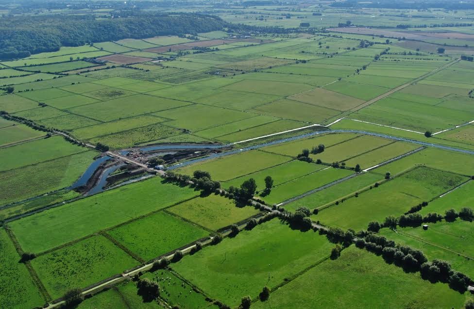
The Levels north of Langport arc across to Glastonbury and Wedmore in one direction and over to Bridgwater and the Parrett estuary in the other. In these northern Levels, the areas most devastated by the 2014 floods here were between Burrowbridge and Bridgwater and most especially the community of Moorlands and Fordgate. The problem here tends to be exacerbated by the fact that Burrowbridge is where the River Tone enters the River Parrett. Excess water is “stored” on Curry Moor (between Stoke St Gregory and the A361) and North Moor (between the A361 and Westonzoyland).
This year, much as in 2014, as the waters started to rise following persistent January rain, an emergency was declared on 17 January.